A Guide to Well Monitoring

Whether you’re trying to analyze the potential of a property for residential or commercial use, knowing about the groundwater in the area is essential for development. To do so, contractors utilize a process called well monitoring. The following guide explains what this entails.
FAQ About Well Monitoring
What is groundwater?
Groundwater refers to water that has passed through the Earth's surface and collected in underground lakes called aquifers. It is often used as drinking water, to nourish crops, and for industrial processes like washing or cooling products or powering machinery.
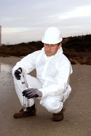
What is well monitoring?
While most wells produce water for households or communities, monitoring wells are often smaller and used solely as a place to gather groundwater samples. Probes monitor the water's levels and quality to determine if there is enough of it to support a planned project. Other tests monitor the water's flow and pressure. In some cases, existing wells can be converted to this purpose.
 Why is this testing important?
In addition to the above, this information provides insight about the health of the local ecosystem. For example, monitoring wells are often drilled near landfills to see how chemicals from the waste have harmed the land.
Well monitoring is also used for scientific studies to provide supporting evidence for environmental regulations.
How does well monitoring work?
Geo-technical drilling contractors utilize a small diameter tube containing a pressure transmitter to monitor water levels. Sometimes dyes are injected into the water to trace its movement. These aspects will often change depending on environmental factors like rain or drought, so the tests may be repeated seasonally to track these fluctuations.
If you need to monitor the groundwater in your area, contact GeoTek Alaska in Anchorage. This geophysical services company has almost 20 years of experience using cost-effective data collection systems. They provide groundwater sampling and auger drilling. Their smaller rigs mean they can access remote locations. They’ve completed projects across the state, using environmentally friendly methods that don’t disrupt the natural terrain. Call them at (907) 569-5900 to speak to a geoscientist today. Learn more about their capabilities on their website.
