A Guide on Orthomosaic Maps

Technological advancements have made aerial imaging more accurate and reliable than ever. As such, it paved the way for photogrammetry, the science of measuring exact distances using rendered and actual images like orthomosaic maps. Here’s what you should know about this mapping method.
What Is an Orthomosaic Map?
 An orthomosaic map is the most useful map in the construction, real estate, and agricultural industries. It is an aerial imaging output comprised of several photos stitched together. Unlike most maps, it is free of aberrations, such as camera tilt, lens distortion, and topographical relief, using orthorectification or the process of correcting images geometrically. The result is a highly detailed 3D model with accurate measurements.
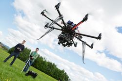
So, why is there a need to rectify aerial imaging photos? When a camera-carrying drone flies over terrain, it captures multiple overlapping images. Since the camera points directly downwards, it causes distortions from uneven terrain and perspective, resulting in less than precise photos. Orthorectification is an intensive process that uses software to analyze, cross-reference, calibrate, and combine photos for creating an orthomosaic map.
How Is It Used?
The uses for an orthomosaic map are numerous, most notably to industries dealing with large swaths of land:
-
Construction: Engineers can utilize orthomosaic maps in all aspects of the project—from land surveying and planning structures to constructing buildings and documenting after completion. Its accuracy is useful for preventing potential liability issues after construction is complete.
-
Real Estate: An orthoimage provides details otherwise impossible with regular photos, allowing real estate agents to better market property to potential buyers. Some orthomosaic maps are interactive, which makes virtual tours more accessible.
- Urban planning: City engineers and planners need all the geographical data they can get when building infrastructures, like pipelines, utility poles, train tracks, and sewer systems. Since these can be affected by changes in the terrain from natural disasters like flooding and earthquakes, an orthoimage lets engineers estimate the potential risk to the urban population before putting these infrastructures in place.
-
Agriculture: Farmers have to deal with changing climate and land conditions, which can have significant effects on their yearly crop yield. With orthomosaic maps, they can pinpoint possible problems, like crop disease and flooding, which can ruin their harvest and hurt them financially.
When you need an orthomosaic map, turn to the professionals at Mid-Penn Engineering in Lewisburg, PA. This structural engineering firm provides an extensive range of services, such as civil engineering, land surveying, aerial imaging, and designing structures to clients throughout central Pennsylvania. Call (570) 524-2214 for an initial consultation or learn more about them online.
