FAQs About Flood Elevation Certificates in Alabama

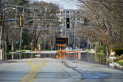
Residents love Alabama because of its rich culture, beautiful green countryside, and commitment to sports and southern hospitality. Unfortunately, the area is also prone to issues with flooding, largely due to its humid and subtropical location. Alabama is also prone to receive the brunt of natural disasters such as hurricanes, which is why having a flood elevation certificate in hand can be helpful. Below are a few common flood elevation certificate questions so that you can better protect your property.
Frequently Asked Questions About Flood Elevation Certificates
What are flood elevation certificates?
Flood elevation certificates, also referred to as ECs, are surveys conducted of your property stating your home’s location and topographical height in relation to the estimated height of projected floodwaters in the area. EC’s include the property address, owner’s information, square footage, and potential openings for floodwaters to access, as well as flood zone designation and depth.
Who needs them?
Whether or not you need an EC depends on whether you want a flood insurance policy and who you receive your insurance policy through. If you live in a high-risk area and you request a flood insurance policy that happens to be underwritten by a federally regulated insurance lender, you will be required to have a Flood Elevation Certificate. On the other hand, many private insurers do not require ECs.
How are certificates used?
 ECs are largely used to calculate your flood insurance premiums since they directly correspond with the likelihood of suffering losses during a potential flood. However, these important surveys can also be used to ensure compliance during community planning or request changes to flood maps.
How can you get a copy of your elevation certificate?
If you have never received an EC before, you should work with a licensed surveyor to have your own property survey conducted. However, if you know an EC has been conducted previously, you may be able to get it from the home sellers, your builder or developer, or the property deed.
Whether you need a flood elevation certificate or a fenceline survey, the team at Raber Surveying in Summerdale, AL, can help. For more than 20 years, this trusted team of professionals has been helping their clients to understand their property and plan for the future. To find out more about their topographical, construction, land, lot, and quantity surveying, visit their website. Give their office a call at (251) 975-7525 for additional questions.
About the Business

