If you’re planning on buying or selling a piece of property, there are many steps to take to ensure a successful sale. One of the most important involves land surveying. However, you may be wondering what the process is and why it’s so crucial. To better understand how it works and why you need it, consult the guide below.
Land Surveying FAQ
What is land surveying?
Land surveying is a professional process that involves mapping out a piece of land. By creating a three-dimensional replica of the plot, technicians establish boundaries of the property, examine the terrain, and make a note of any natural or man-made landmarks.
Why are land surveys crucial?
 Surveys help property owners understand their rights when maintaining and expanding upon a piece of land. For instance, perhaps you recently bought land and want to build a fence on the perimeter. To do this, you need to know exactly how far your land extends. This ensures complete privacy and prevents legal problems, as building on another person’s property could lead to a lawsuit.
What tools do surveyors use?
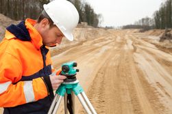
Technicians use a variety of high-quality equipment during their readings. These include existing maps and deeds as a starting point, as well as measuring tapes and GPS to ensure accuracy.
How long are the survey results valid?
In theory, the findings in the land survey should be valid indefinitely. However, the survey needs to be updated as you make changes to your property, including purchasing surrounding plots or selling off a piece of your land.
If you recently purchased a piece of property and need land surveying services to determine its boundaries, turn to the team at Mid-Penn Engineering in Lewisburg, PA. Since 1969, they’ve helped residents with everything from aerial imaging to structural engineering. Visit them online to learn more about their firm, or call (570) 524-2214 to schedule an appointment today.
About the Business
Have a question? Ask the experts!
Send your question

